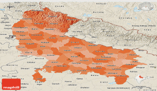
Jhansi (Jhānsi)
Jhansi (Hindi: झांसी, Urdu: ) is a historic city in the Indian state of Uttar Pradesh. Balwant Nagar was the old name of Jhansi. It lies in the region of Bundelkhand on the banks of the Pahuj River, in the extreme south of Uttar Pradesh. Jhansi is the administrative headquarters of Jhansi district and Jhansi division. Also called the Gateway to Bundelkhand, Jhansi is situated near and around the rivers Pahuj and Betwa at an average elevation of 285 m. It is about 420 km from national capital New Delhi and 315 km from state capital Lucknow.
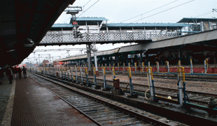
Jhansi is well connected to all other major towns in Uttar Pradesh by road and railway networks. The National Highways Development Project has supported development of the city. Jhansi is also being developed as the defense corridor by the NDA government which will boost the economy of the city and the region at the same time. Srinagar to Kanyakumari north–south corridor passes closely to Jhansi, as does the east–west corridor; consequently there has been a sudden rush of infrastructure and real estate development in the city. Jhansi was adjudged the third cleanest city of Uttar Pradesh and the fastest moving city in the North Zone in Swachh Survekshan 2018 rankings. The development of a greenfield airport has been planned in the city. On 28 August 2011 Jhansi was selected among 98 cities for smart city initiative by Government of India.
During ancient times, Jhansi was a stronghold of the Chandela Rajput kings and was known as Balwant Nagar. However, it lost importance in the 11th century after the decline of the Chandela dynasty. It rose in prominence in the 17th century when a Rajput Raja Bir Singh Deo of Orchha State constructed the Jhansi Fort in 1613.
Jhansi came under the Maratha Empire in 1729 when Maharaja Chattrasal offered Jhansi and some other parts of his state to the Maratha Peshwa Baji Rao I as a mark of gratitude for having helped him in defeating the Nawaf of Farrukhabad Muhammad Khan Bangash who had attacked Maharaja Chattrasal's kingdom.
In the 18th century, the town of Jhansi served as the capital of a Maratha province and later the Princely State of Jhansi from 1804 till 1858, when the territory became a part of British India.
After the independence of India, Jhansi was included in the state of Uttar Pradesh
Map - Jhansi (Jhānsi)
Map


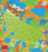


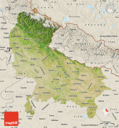

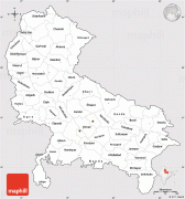

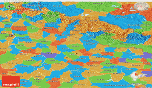


Country - India
 |
 |
| Flag of India | |
Modern humans arrived on the Indian subcontinent from Africa no later than 55,000 years ago. Their long occupation, initially in varying forms of isolation as hunter-gatherers, has made the region highly diverse, second only to Africa in human genetic diversity. Settled life emerged on the subcontinent in the western margins of the Indus river basin 9,000 years ago, evolving gradually into the Indus Valley Civilisation of the third millennium BCE. By, an archaic form of Sanskrit, an Indo-European language, had diffused into India from the northwest. (a) (b) (c), "In Punjab, a dry region with grasslands watered by five rivers (hence ‘panch’ and ‘ab’) draining the western Himalayas, one prehistoric culture left no material remains, but some of its ritual texts were preserved orally over the millennia. The culture is called Aryan, and evidence in its texts indicates that it spread slowly south-east, following the course of the Yamuna and Ganga Rivers. Its elite called itself Arya (pure) and distinguished themselves sharply from others. Aryans led kin groups organized as nomadic horse-herding tribes. Their ritual texts are called Vedas, composed in Sanskrit. Vedic Sanskrit is recorded only in hymns that were part of Vedic rituals to Aryan gods. To be Aryan apparently meant to belong to the elite among pastoral tribes. Texts that record Aryan culture are not precisely datable, but they seem to begin around 1200 BCE with four collections of Vedic hymns (Rg, Sama, Yajur, and Artharva)."
Currency / Language
| ISO | Currency | Symbol | Significant figures |
|---|---|---|---|
| INR | Indian rupee | ₹ | 2 |
| ISO | Language |
|---|---|
| AS | Assamese language |
| BN | Bengali language |
| BH | Bihari languages |
| EN | English language |
| GU | Gujarati language |
| HI | Hindi |
| KN | Kannada language |
| ML | Malayalam language |
| MR | Marathi language |
| OR | Oriya language |
| PA | Panjabi language |
| TA | Tamil language |
| TE | Telugu language |
| UR | Urdu |